Visit Madagascar

Discover the rich cultural, wildlife and landscape diversity of Madagascar

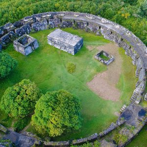
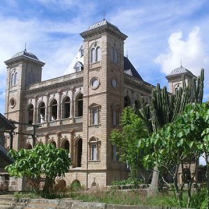
An island nation often called the Eighth Continent; with multiple micro-climates; and many ethnic groups each with their own dialect, style, music, architecture and way of life; any visit to Madagascar is fascinating and eye-opening.

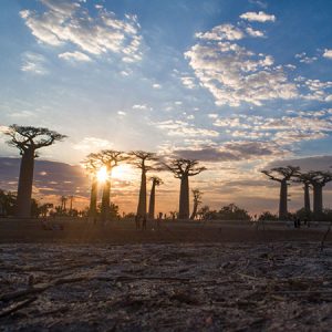
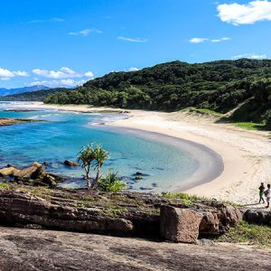
From the stunning beaches and scuba diving of the south west, through the rugged central highlands, to dense rainforests in the east, a visit to Madagascar has something for everyone. Discover the red island with Dadamanga, the Madagascar travel operator with over 25 years experience.

Discover Madagascar

Madagascar is a vast country with a lot to see, but there are some big distances and travel times. Use the map below to get an overview of where everything is and what you can see on our example tours.

Diego & North Madagascar
Fort Dauphin & the South East
Toliara & the South West
Toamasina & East Madagascar
Morondava & West Madagascar
Tana & the Central Highlands
Example tours

Madagascar tour itineraries

Not sure where you want to go, or how long it takes to get around? Take a look at one of our example tour itineraries below.

Antananarivo – Riverboat to the Tsingy of Bemaraha – Kirindy – Avenue of Baobabs – Andasibe – Antananarivo
Antananarivo – Tsingy de Bemaraha – Morondava – Avenue of the Baobabs – Isalo – Ranomafana – Rova Palace – Masoala – Andasibe – Antananarivo
Antananarivo – Diego Suarez – Amber Mountain – Red Tsingy – Tsingy of Ankarana – Emerald Sea – Andasibe – Palmarium (aye-ayes) – Antananarivo
Antananarivo – Andasibe – Pangalanes Canal – Palmarium Reserve – Aye-Aye lemurs – Toamasina – Sainte Marie – Whale watching – Antananarivo tour
Antananarivo – Antsirabe – Ranomafana NP – Anja Park – Hiking in Isalo NP – Zombitse NP – Snorkeling in Ifaty – Perfect beaches – Arboretum d’Antsokay – Antananarivo

Explore the main regions:

Situated deep in the southeast, Fort Dauphin otherwise known as Tolagnaro, is built mainly on a promontory surrounded by white-sand beaches, under high forest-clad mountains and has an undeniable charm. Once the centre of a prosperous tourist industry, the town these days is more forgotten and very peaceful. The city is dominated by the Anosyenne mountain chain and Pic St. Louis, the view from which offers a unique and unspoiled panorama across the area. Surrounded to the north, east, and south by the bright azure colors of the Indian Ocean, the town offers the visitor a variety of pastimes like strolling through the markets, lazing on the fine sandy beaches, enjoying the local cuisine or exploring the sensational forests and reserves within easy reach.
Antsiranana, known as Diego Suarez until 1975 and still called Diego by many, is the capital of Madagascar’s north. It has one of the world’s most beautiful deep-water harbors, complete with the photogenic Sugarloaf Mountain, and it is probably the most French (and increasingly Italian) city in Madagascar. Diego has a huge market, a range of pretty-good restaurants, and some fantastic attractions and national parks to visit nearby. It is the kite-surf capital of Madagascar.
Toamasina (commonly known as Tamatave) is Madagascar’s second city, the site of the most important national seaport, is a busy coastal city with many economic activities. Being tropical, it is a hub for spices and tropical fruits, the famous lychees being exported to Europe every year. It is the jump-off point for south-bound trips down the Pangalanes Canal, or north-bound to the port that leads you to Sainte Marie Island, and for the most intrepid travellers, it is the departure point heading north on the treacherous National Highway 5 (RN5).
Madagascar’s wild and beautiful west coast is a dream for adventurous travelers, offering dramatic landscapes, unique wildlife, and unforgettable sunsets. Near the coastal town of Morondava, visitors can experience one of the island’s most iconic sights—the towering limestone pinnacles of the Tsingy de Bemaraha, a UNESCO-listed natural wonder where razor-sharp rock formations create a surreal “stone forest.” Just as breathtaking is the famous Avenue of the Baobabs, a striking dirt road lined with ancient, massive baobab trees that glow spectacularly at sunrise and sunset.The region is known for its warm, dry climate, especially during the long dry season from April to November, making it ideal for exploring national parks, quiet beaches, and remote villages along the Mozambique Channel. Together, the landscapes, wildlife, and laid-back coastal atmosphere make Madagascar’s west coast one of the island’s most captivating destinations.
Toliara (or Tulear) is the south-west’s capital, a town of approximately 70,000 inhabitants created in 1895 by a French architect, who gave great importance to planting trees in the city, which offer welcome shade from the blazing sun. Hot and sunny, Tulear is the gateway to the great southern reef, and the beach towns of Anakao (south) and Ifaty Mangily (north). It is surrounded by some spectacular table-mountain formations covered in the unique southern spiny forest and has significant mangroves and coral reef.
The central plateau forms the core of the island, where the capital Antananarivo (usually known as Tana) and other important cities are located. The landscape is dominated by terraced rice fields that attest to the Asian origin of the Merina & Betsileo people who share this region. Along National Highway 7 (RN7), from Antananarivo to Fianarantsoa, there are also some of the most visited tourist towns of the island.

We've got the local knowledge

Get to know more about the amazing wildlife, culture, and history of Madagascar before you arrive – it will make your Madagascar vacation even more special!